Madeira hiking trails map: every PR walk by area
Madeira has 42 classified walking routes, numbered PR, including 3 on Porto Santo. Most need a SIMplifica booking and cost €4.50; 4 are run by local councils and need no booking at all.
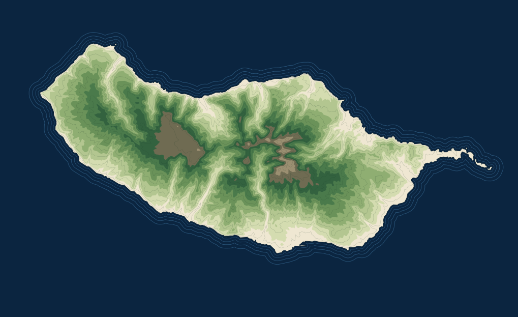
Each pin is a road access point, labelled with its PR numbers. Tap one to see the trails that start there.
Distances, start and end points and notes: IFCN: classified walking routes, updated 2 October 2026. Times, difficulty, height and access points: Visit Madeira. Both checked 22 October 2026. Status changes daily: check it on the day.
Central peaks
The three highest peaks and the paths that link them, including the one-way PR1. Check the mountain weather before you go.
- PR1
Vereda do Arieiro
ModeratePico do Arieiro → Pico Ruivo
Madeira's best-known ridge walk, between the three highest peaks, from Pico do Arieiro (1,818 m) to Pico Ruivo (1,862 m).
- Distance
- 6.1 km
- Time
- 3 h
- Height
- 1,491–1,857 m
- Fee
- €4.50 to Pedra Rija · €10.50 to Pico Ruivo
Two-way only between Pico do Arieiro and Pedra Rija; one-way towards Pico Ruivo after that. The east variant over Pico das Torres is closed; the route uses the west variant through the tunnels.
Our full PR1 guide How the one-way PR1 works Route on Visit Madeira
- PR1.1
Vereda da Ilha
ModeratePico Ruivo → Ilha
A long descent from Pico Ruivo to the village of Ilha, from mountain heath into laurel forest, with about 1,376 m of height difference.
- Distance
- 8.2 km
- Time
- 3 h
- Height
- 490–1,764 m
- Fee
- €4.50
- PR1.2
Vereda do Pico Ruivo
ModerateAchada do Teixeira → Pico Ruivo
The short way up Pico Ruivo, the highest point of Madeira at 1,862 m, starting next to the Homem em Pé rock.
- Distance
- 2.8 km + 2.8 km back
- Time
- 1 h 30
- Fee
- €4.50
- PR1.3
Vereda da Encumeada
ModeratePico Ruivo → Encumeada
Follows the central mountain range west from Pico Ruivo, crossing high mountain and laurel forest.
- Distance
- 11.2 km
- Time
- 5 h
- Height
- 1,009–1,764 m
- Fee
- Included in the full PR1 ticket
Partly open on the IFCN list of 2 October 2026. Closed between Boca das Torrinhas and Encumeada. From Boca das Torrinhas you can continue on PR2.
- PR2
Vereda do Urzal
ModerateCurral das Freiras → Boaventura
An old path between the south and north coasts, climbing from Curral das Freiras to Boca das Torrinhas and down through laurel forest.
- Distance
- 10.3 km
- Time
- 4 h 30
- Height
- 519–1,450 m
- Fee
- €4.50
- PR12
Caminho Real da Encumeada
ModerateBoca da Corrida → Encumeada
An old cobbled royal path below the highest peaks, once one of the main routes across the island.
- Distance
- 12.5 km
- Time
- 5 h
- Height
- 830–1,323 m
- Fee
- €4.50
Partly open on the IFCN list of 2 October 2026. Passable only from Boca da Corrida to km 3.5.
Rabaçal and Paul da Serra
The Paul da Serra plateau and the Rabaçal valley below it, home to 25 Fontes, Risco and the rest of the PR6 family.
- PR6
Levada das 25 Fontes
ModerateRabaçal → 25 Fontes
Along the levada from Rabaçal to the 25 Fontes lagoon, fed by springs coming down from Paul da Serra.
- Distance
- 4.3 km + 4.3 km back
- Time
- 3 h
- Height
- 964–1,288 m
- Fee
- €4.50
Controlled one-way circulation: out along the levada, back by the alternative path called the bypass.
- PR6.1
Levada do Risco
EasyRabaçal → Risco
Shares the start with PR6 and ends at the Risco viewpoint, facing a tall waterfall.
- Distance
- 1.5 km + 1.5 km back
- Time
- 2 h
- Height
- 1,000–1,288 m
- Fee
- €4.50
With time and energy left, carry on along the PR6 to 25 Fontes (4.3 km, about 3 h).
- PR6.2
Levada do Alecrim
EasyRabaçal → Source of the levada
Follows the Levada do Alecrim at about 1,300 m to its spring and the pool called Lagoa Dona Beja, through heather tunnels.
- Distance
- 3.5 km + 3.5 km back
- Time
- 2 h 30
- Height
- 1,256–1,339 m
- Fee
- €4.50
- PR6.3
Vereda da Lagoa do Vento
EasyRabaçal → Lagoa do Vento
A short path from the Rabaçal shelter to the Lagoa do Vento, between mountain heath and laurel forest.
- Distance
- 1.8 km + 1.8 km back
- Time
- 1 h 30
- Fee
- €4.50
- PR6.4
Levada Velha do Rabaçal
Not gradedPico Gordo → Casa do Rabaçal
From Pico Gordo down to the old Rabaçal levada and on to Casa do Rabaçal; the 1855 Túnel das Estrebarias is a short detour.
- Distance
- 5 km
- Time
- 2 h
- Height
- 1,038–1,190 m
- Fee
- €4.50
- PR6.5
Vereda do Pico Fernandes
Not gradedPaul da Serra → 25 Fontes
An old footpath from the Paul da Serra plateau past Pico Fernandes, down to the 25 Fontes lagoon.
- Distance
- 3.8 km
- Time
- 1 h 30
- Height
- 990–1,422 m
- Fee
- €4.50
- PR6.6
Vereda do Túnel do Cavalo
Not gradedCaldeira picnic area → Casa do Rabaçal
A forest track and the Túnel do Cavalo, finished in 1877, from the Caldeira picnic area to Casa do Rabaçal.
- Distance
- 2.3 km
- Time
- 45 min
- Height
- 988–1,055 m
- Fee
- €4.50
- PR6.7
Vereda da Câmara de Carga do Rabaçal
Not gradedRabaçal → Túnel do Cavalo
A short link between Rabaçal and the Túnel do Cavalo.
- Distance
- 1.8 km
- Time
- n/a
- Fee
- €4.50
- PR6.8
Levada do Paul II, a path for everyone
Not gradedRabaçal → Estrada do Rochão
A level path along the Levada do Paul II, prepared for people with reduced mobility.
- Distance
- 1.2 km
- Time
- 30 min
- Height
- 1,279–1,280 m
- Fee
- €4.50
- PR13.1
Vereda da Palha Carga
Not gradedLouro da Gota → 25 Fontes
From Louro da Gota across mountain heath to 25 Fontes, with views over Rabaçal and Ribeira da Janela.
- Distance
- 1.8 km
- Time
- 45 min
- Height
- 970–1,328 m
- Fee
- €4.50
- PR27
Glaciar de Planalto
Not gradedBica da Cana → ER 105
Across the Paul da Serra plateau from Bica da Cana, past landforms left by an ice-age glacier.
- Distance
- 4.6 km
- Time
- 1 h 30
- Height
- 1,457–1,588 m
- Fee
- €4.50
Closed on the IFCN list of 2 October 2026. Check today’s status.
Fanal and the north-west
Old laurel forest around Fanal and paths down towards Ribeira da Janela and Porto Moniz.
- PR7
Levada do Moinho
ModerateRibeira da Cruz → Lamaceiros
A levada past the ruins of old water mills, near the border of Porto Moniz and Calheta.
- Distance
- 10.5 km
- Time
- 3 h 30
- Height
- 504–940 m
- Fee
- €4.50
Closed on the IFCN list of 2 October 2026. Check today’s status.
- PR13
Vereda do Fanal
ModeratePaul da Serra → Fanal
Across the edge of the Paul da Serra plateau and down through laurel forest to Fanal and its old til trees.
- Distance
- 10.8 km
- Time
- 4 h
- Height
- 1,130–1,420 m
- Fee
- €4.50
- PR14
Levada dos Cedros
ModerateFanal → Curral Falso
Along a 17th-century levada, from Fanal through centuries-old til trees to Curral Falso.
- Distance
- 7.2 km
- Time
- 3 h
- Height
- 840–1,090 m
- Fee
- €4.50
- PR15
Vereda da Ribeira da Janela
ModerateCurral Falso → Ribeira da Janela
Mostly downhill on an old wood-carriers’ path from Curral Falso to the village of Ribeira da Janela.
- Distance
- 2.7 km
- Time
- 1 h 30
- Height
- 400–820 m
- Fee
- €4.50
- PR28
Levada da Rocha Vermelha
Not gradedFanal → Casa dos guardas de canal
From Fanal along PR13, then down a steep staircase beside the fast-running Levada da Rocha Vermelha.
- Distance
- 10.7 km
- Time
- 4 h
- Height
- 837–1,297 m
- Fee
- €4.50
Closed on the IFCN list of 2 October 2026. Check today’s status.
Encumeada
The pass between the south and north coasts, with routes in both directions and a short forest loop.
- PR17
Caminho do Pináculo e Folhadal
DifficultLombo do Mouro → Encumeada
The only route graded difficult: levadas and paved paths up to the Pináculo, with a view over the Ribeira Brava valley.
- Distance
- 15 km
- Time
- 6 h 30
- Height
- 970–1,490 m
- Fee
- €4.50
Partly open on the IFCN list of 2 October 2026. Passable only between Encumeada, Folhadal, Caramujo and Bica da Cana.
- PR21
Caminho do Norte
ModerateEncumeada → Ribeira Grande
An old trading path from Encumeada down towards the north coast, through laurel forest.
- Distance
- 3.2 km
- Time
- 1 h 30
- Height
- 320–1,000 m
- Fee
- €4.50
- PR22
Vereda do Chão dos Louros
EasyChão dos Louros → Chão dos Louros
A short circular walk in the Chão dos Louros forest park, which you can join at several points.
- Distance
- 1.9 km
- Time
- 45 min
- Height
- 830–890 m
- Fee
- €4.50
Santana and the north
Levadas through laurel forest on the north side, from Queimadas to Caldeirão Verde, São Jorge and São Vicente.
- PR9
Levada do Caldeirão Verde
ModerateQueimadas → Caldeirão do Inferno
A long levada walk from the thatched Queimadas shelter through laurel forest to the Caldeirão Verde waterfall.
- Distance
- 8.7 km + 8.7 km back
- Time
- 6 h 30
- Height
- 872–1,020 m
- Fee
- €4.50
- PR9.1
Levada do Caldeirão Verde, a path for everyone
Not gradedQueimadas → Pico das Pedras
The accessible section of the Caldeirão Verde levada, prepared for people with reduced mobility or visual impairment.
- Distance
- 1.9 km
- Time
- 45 min
- Height
- 870–890 m
- Fee
- €4.50
- PR16
Levada Fajã do Rodrigues
ModerateFajã da Ama → Ribeira do Inferno
A levada with tunnels and waterfalls, from Ginjas near São Vicente to the Ribeira do Inferno.
- Distance
- 3.9 km + 3.9 km back
- Time
- 3 h 30
- Height
- 600–630 m
- Fee
- €4.50
- PR18
Levada do Rei
ModerateQuebradas → Ribeiro Bonito
From Quebradas in São Jorge through farmland and laurel forest to the source at Ribeiro Bonito.
- Distance
- 5.3 km + 5.3 km back
- Time
- 3 h 30
- Height
- 535–573 m
- Fee
- €4.50
East
Ribeiro Frio, Portela and the bare eastern peninsula of Ponta de São Lourenço.
- PR5
Vereda das Funduras
ModeratePortela → Maroços
From the Portela viewpoint through the hills of Machico to Maroços, with the Penha d'Águia rock in view.
- Distance
- 8.7 km
- Time
- 3 h
- Height
- 186–624 m
- Fee
- €4.50
- PR8
Vereda da Ponta de São Lourenço
ModerateBaía d'Abra → Cais do Sardinha
Along the volcanic eastern peninsula, with the north and south coasts in view at the same time.
- Distance
- 4 km + 4 km back
- Time
- 2 h 30
- Fee
- €4.50
Visit Madeira lists temporary diversions: follow the signs on the ground.
By bus: Line 702 (old 113) runs from Funchal to Baía d’Abra, where the trail starts, in about 1 hour 20 minutes. Bus times
Our full PR8 guide No car? Transfer from Funchal Route on Visit Madeira
- PR10
Levada do Furado
ModerateRibeiro Frio → Portela
One of the island's oldest public levadas, from Ribeiro Frio to Portela, with views of Penha d'Águia.
- Distance
- 11 km
- Time
- 5 h
- Height
- 645–880 m
- Fee
- €4.50
- PR11
Vereda dos Balcões
EasyRibeiro Frio → Balcões
A short, almost level walk beside a levada to the Balcões viewpoint over the north-east valleys.
- Distance
- 1.5 km + 1.5 km back
- Time
- 1 h 30
- Height
- 870–880 m
- Fee
- €4.50
By bus: Lines 801 and 850 (old 56 and 103) run from Funchal to Ribeiro Frio, where the trail starts. Bus times
Funchal and Caniço
Routes managed by the Funchal and Caniço councils. You walk them without a SIMplifica booking.
- PR3
Vereda do Burro
EasyPico do Arieiro → Ribeira das Cales
From just below Pico do Arieiro down through high-mountain vegetation to the Funchal Ecological Park.
- Distance
- 6.7 km
- Time
- 2 h 40
- Height
- 1,130–1,805 m
- Fee
- Free, no booking
Managed by Funchal council, outside the SIMplifica booking system.
- PR3.1
Caminho Real do Monte
ModerateRibeira das Cales → Monte
From the Funchal Ecological Park down to Monte, past the 1784 Levada das Cales and the Pico Alto viewpoint.
- Distance
- 5.5 km
- Time
- 2 h
- Height
- 550–1,130 m
- Fee
- Free, no booking
Managed by Funchal council, outside the SIMplifica booking system.
- PR4
Levada do Barreiro
EasyPoço da Neve → Casa do Barreiro
From Poço da Neve, an ice house built in 1813, along a levada with views over Funchal.
- Distance
- 6.7 km
- Time
- 2 h 10
- Height
- 975–1,650 m
- Fee
- Free, no booking
Partly open on the IFCN list of 2 October 2026. Only partially passable.
Managed by Funchal council, outside the SIMplifica booking system.
- PR23
Levada da Azenha
Not gradedAzenha → Caminho Velho do Castelo
A short levada walk in Caniço, managed by the parish council.
- Distance
- 1.3 km
- Time
- n/a
- Fee
- Free, no booking
Managed by the Caniço parish council, outside the SIMplifica booking system. No access point is published, so it is not on the map.
South-west coast
Old stepped paths from Prazeres down to the fishing villages.
- PR19
Caminho Real do Paul do Mar
ModeratePrazeres → Paul do Mar
A stepped path that zig-zags from Prazeres down to the fishing village of Paul do Mar, past farm terraces.
- Distance
- 1.8 km
- Time
- 1 h 20
- Height
- 16–550 m
- Fee
- €4.50
- PR20
Vereda do Jardim do Mar
EasyPrazeres → Jardim do Mar
An old path from Prazeres down to Jardim do Mar, about 500 m of descent with the sea in front.
- Distance
- 1.9 km
- Time
- 1 h 30
- Height
- 35–530 m
- Fee
- €4.50
Closed on the IFCN list of 2 October 2026. Check today’s status.
Porto Santo
Not on the map: Porto Santo is about 40 km north-east of Madeira.
- PS PR1
Vereda do Pico Branco e Terra Chã
ModerateER 111 → Terra Chã
From the road past the Rocha Quebrada rock formation to Pico Branco and Terra Chã.
- Distance
- 2.7 km + 2.7 km back
- Time
- 1 h 30
- Height
- 184–450 m
- Fee
- €4.50
- PS PR2
Vereda do Pico do Castelo
EasyMoledo → Pico do Castelo
Two ways up Pico do Castelo from Moledo, one round each side of Pico do Facho.
- Distance
- 3.2 km or 4.6 km
- Time
- 2 h 15
- Height
- 225–435 m
- Fee
- €4.50
- PS PR3
Levada do Pico do Castelo
ModerateCamacha → Capela da Graça
A levada along the southern foot of Pico do Castelo, from Camacha towards the Graça chapel.
- Distance
- 4.1 km
- Time
- 1 h 30
- Height
- 80–210 m
- Fee
- €4.50
Closed on the IFCN list of 2 October 2026. Check today’s status.
What a levada walk feels like
Many of these trails follow levadas, the irrigation channels that carry water across the island. You walk on the path beside the channel, often under laurel forest, with ferns and moss on the banks and the sound of running water most of the way.
Levada walks are usually flatter than the mountain trails, because the channel has to keep a gentle slope. They can still be narrow, wet and exposed in places, so read the notes on each trail card before you choose.
Booking a PR trail?
Step-by-step SIMplifica booking, the fee calculator for several trails, refunds and the PR1 rules are in one guide.